Things To Do
Jersey Coastal Path and Cliff Path Walks: Route Maps and Trail Guides
Updated 16 October 2026
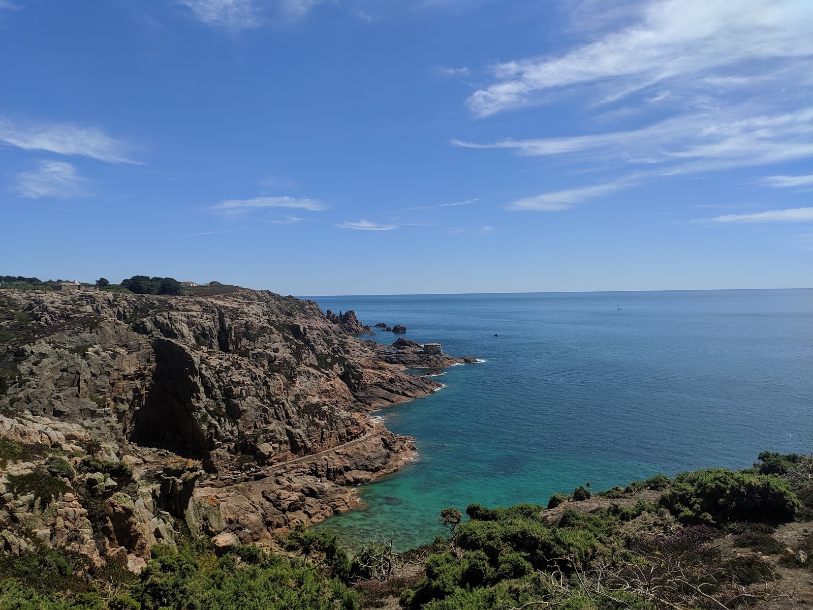
When planning outdoor routes across the Channel Islands, few places offer as much natural drama within a compact area as Jersey. Measuring roughly nine miles by five, the island is girdled by an exceptional coastal rim. Towering granite cliffs drop sheer into Atlantic waters along the northern shore, sweeping bays of pale sand define the west and south, and vast tidal flats dotted with historic defence towers stretch across the east. For walkers, this geography makes Jersey coastal walks remarkably varied: in a single outing, you can cross open heather-clad headlands, drop down into wooded coastal valleys, and stroll along wide seafront promenades.
Whether you want to take on the complete circuit of the island or break the shoreline down into bite-sized half-day excursions, understanding the trail network is essential. Jersey offers an integrated system of paths, ranging from paved former railway corridors to rugged cliff tracks where firm footing and sensible navigation are needed. In this guide, I will take you through Jersey's primary coastal walking segments, how the routes are mapped, what to expect from the terrain, and how to use local public transport to make linear hikes simple and stress-free.
The Geography of Jersey Coastal Walks: An Overview
To grasp the layout of coastal walks in Jersey Channel Islands, it helps to understand the island's natural tilt. Jersey rises steeply from the sea along its northern coast, where rugged granite cliffs reach heights of up to 100 metres, before sloping gently southward toward the shallow, sunlit waters of St Aubin's Bay and Grouville. This uneven profile gives each coastal quadrant a distinct personality and terrain grade.
For long-distance hikers, the benchmark route is the complete Jersey Coastal Walk. Spanning approximately 80 kilometres (50 miles), this continuous circuit forms an integral section of the wider Channel Island Way. Completing the entire loop allows you to experience every facet of Jersey's shoreline. The route closely follows the footprint of the island's famous Around the Island Walk, a demanding 48-mile charity event held annually that guides walkers across the beaches, cliffs, and rural lanes of the island.
For most leisure visitors, the coast is best enjoyed in modular day stages ranging from 5 to 13 kilometres (3 to 8 miles) each. Because Jersey is criss-crossed by quiet lanes, you can easily link these sections into longer itineraries or tackle them individually. A substantial portion of this perimeter is protected within the Jersey National Park, which embraces over 30 miles of coastline and maintains more than 50 miles of public footpaths and permissive tracks.
Key Walking Sections and Cliff Path Highlights
Jersey's shoreline divides naturally into four distinct walking sectors, each presenting a different balance of elevation, scenery, and footing.
1. The Rugged North Coast: Plémont to Rozel
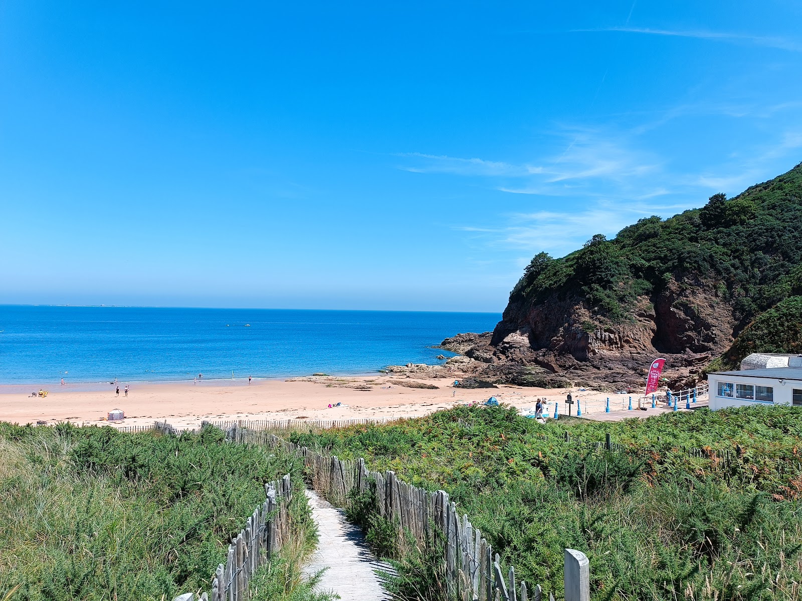
If you want dramatic elevation changes and sweeping sea views, the north coast cliff paths offer the most physical walking on the island. Here, ancient pink-granite bluffs tower over rocky bays and secret coves.
- Plémont to La Grève de Lecq: Beginning near the wild headland of Plémont, famous for its deep sea caves and crashing surf, this cliff path rolls over exposed headlands before descending into the sheltered bay of Grève de Lecq. The high viewpoints provide expansive panoramas across open water toward Sark and Guernsey.
- La Grève de Lecq to the Devil's Hole: Heading east, the trail negotiates undulating heathland towards the Devil's Hole, a dramatic natural blowhole formed by collapsed sea caverns. This segment features steady climbs through bracken and maritime gorse.
- Les Platons to Bouley Bay: Les Platons marks the highest point on Jersey. The surrounding cliff paths are rocky, narrow, and challenging, with uneven steps and steep gradients that test your knees before descending into the protected deep-water haven of Bouley Bay.
- Bouley Bay to Rozel: The final northern stretch links Bouley Bay with the charming fishing harbour of Rozel. This trail ducks through steep coastal valleys like Jardin D'Olivet, where wooded sections can become slippery and muddy underfoot after wet weather.
2. The Sweeping West Coast: Grosnez to St Ouen’s Bay
Jersey's western edge meets the full power of the open Atlantic. The atmosphere here is brisk and expansive, defined by rolling swells, vast skies, and wide coastal dunes.
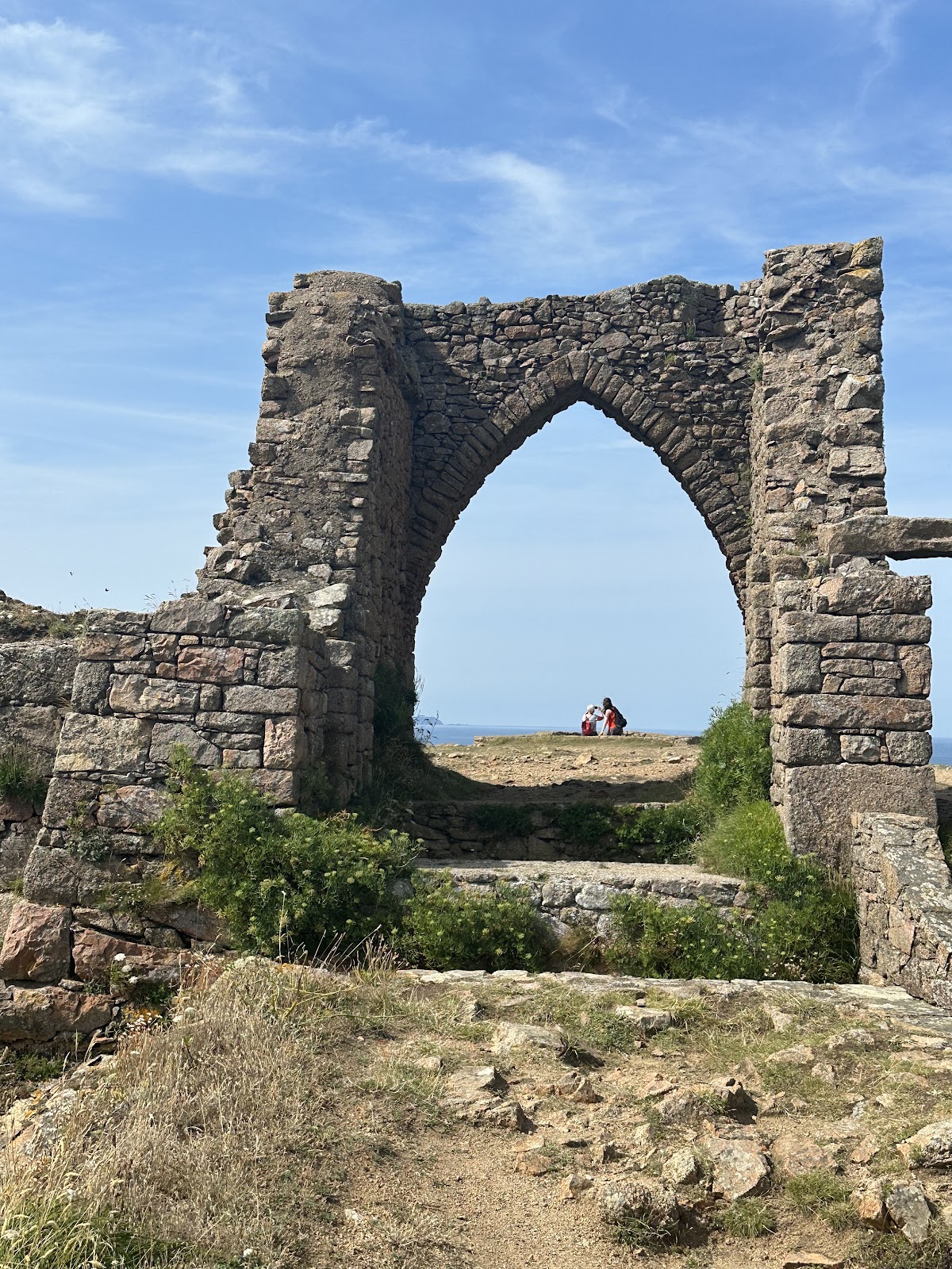
- Grosnez Castle to Les Landes: At the northwestern tip of Jersey stand the historic ruins of Grosnez Castle. The surrounding headland is part of a large ecological Special Site of Interest. Uneven trails cross maritime heathland, leading past Second World War coastal defences at Battery Moltke, managed by the Channel Islands Occupation Society (Jersey) Limited.
- The Expanse of St Ouen's Bay: From the northern bluffs, the coastline curves along the immense sweep of St Ouen's Bay. Known locally as 'The Five Mile Road' after the long thoroughfare behind the sea wall, this area features vast coastal sand dunes (Les Mielles) and steady ocean breakers. Walkers can follow hard-packed sands at low tide, paved sea-wall paths, or nature trails through the dunes.
- The Lieutenant Governor's Challenge: This popular 13-mile challenge segment from the annual charity walk highlights this western transition, starting high on the northern cliffs at Les Fontaines Tavern and guiding walkers across the headlands down to Le Braye.
3. The Scenic Southwest: St Brelade’s Bay to La Corbière
The southwest combines pine-fringed coastal tracks, pale sandy beaches, and windswept granite headlands.
- Noirmont Point and Ouaisné: Starting near St Aubin, paths lead out over Noirmont Common to Noirmont Point, home to naval command bunkers, before descending past red granite cliffs to Ouaisné Common and the sheltered sweep of St Brelade's Bay.
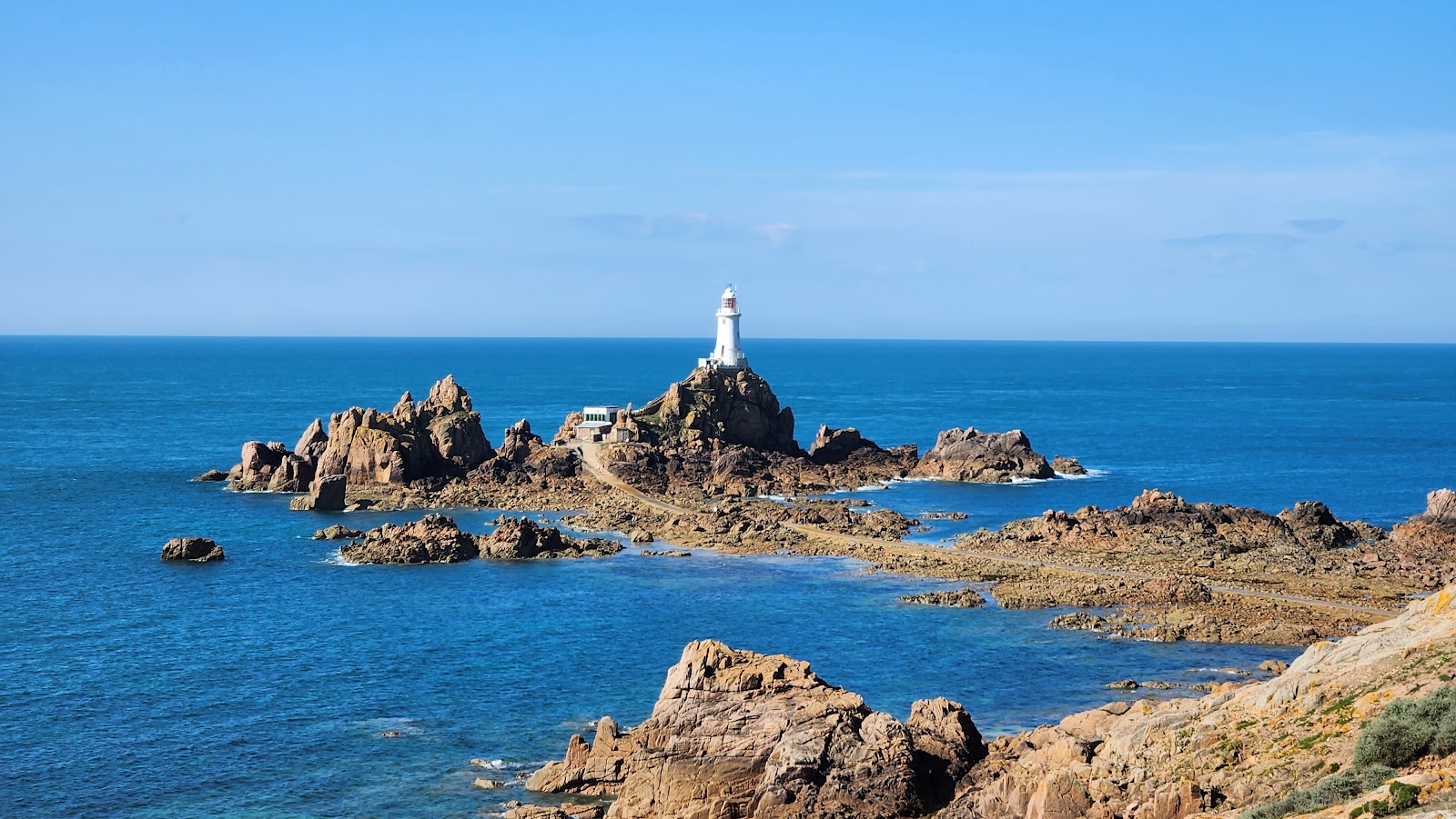
- St Brelade's Bay to La Corbière: From St Brelade's Bay, the coastal route climbs through heath and rocky outcrops toward La Pulente and La Corbière. Approaching the iconic white lighthouse at La Corbière as the tide swirls around its causeway is one of the island's classic sights.
- The Inland Alternative: For an accessible, level route across this corner, the Railway Walk - St Aubin To Corbiere provides a peaceful four-mile path. Following the bed of the historic railway line that ran from 1870 to 1936, this route climbs gently through tree-lined cuttings before opening out near the lighthouse, making it a great alternative if you want to avoid steep cliff scrambles.
4. The Historic East Coast: Rozel, Gorey, and St Clement
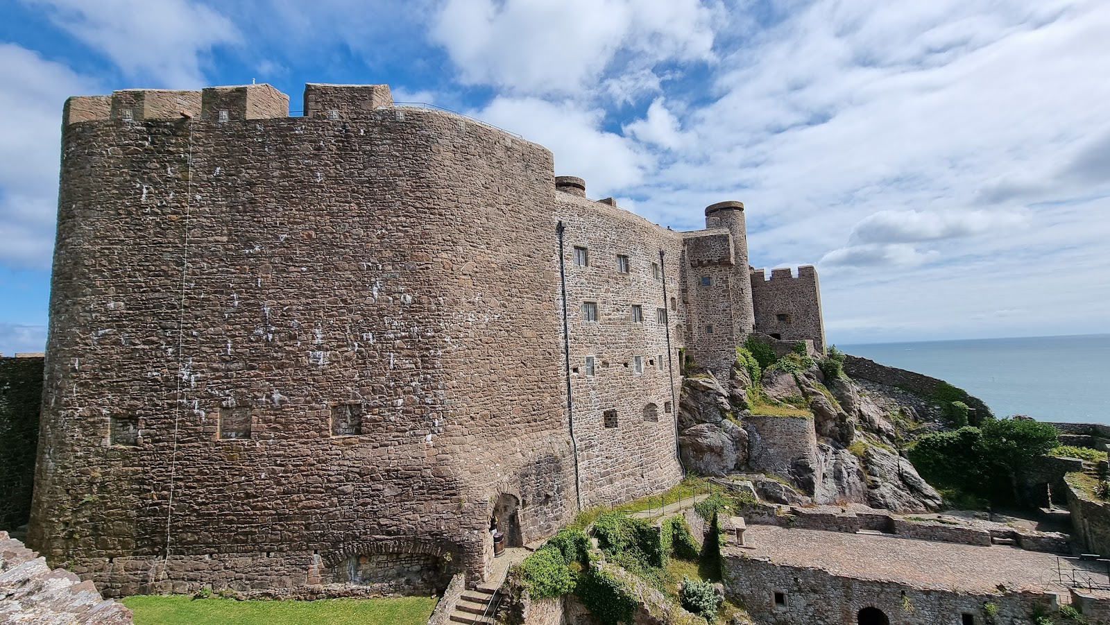
On the eastern coast, the landscape flattens into quiet rural bays looking out across the sea toward the Normandy coast of France.
- Rozel to St Catherine’s: Leaving Rozel, paths weave between tranquil wooded valleys, clifftop lanes, and coastal verges toward the massive Victorian breakwater at St Catherine’s Bay.
- Mont Orgueil Castle and Gorey: Heading south, you encounter the impressive stone ramparts of Mont Orgueil Castle towering over Gorey Harbour. Walking beneath this medieval fortress is a standout moment of any east-coast route.
- The Southeast Shore: Beyond Gorey, the path skirts Grouville Bay towards St Clement. The shoreline here is marked by historic Conway towers, including Le Hocq Tower, an 18th-century round defence tower that now houses an interpretation centre overlooking the vast intertidal reefs.
To help you select the best section for your schedule and fitness level, here is an overview of popular coastal walking stages:
| Trail Section | Distance | Terrain Profile | Difficulty Level |
|---|---|---|---|
| Plémont to Grève de Lecq | 5–7 km (3–4.5 mi) | Exposed clifftops, dirt tracks, steep steps | Moderate to Strenuous |
| Les Platons to Bouley Bay | 6–8 km (3.7–5 mi) | Rocky paths, sharp elevation changes, woods | Challenging |
| Grosnez & Les Landes | 4–6 km (2.5–3.7 mi) | Maritime heathland, uneven gravel tracks | Easy to Moderate |
| St Brelade’s to Corbière | 7–9 km (4.3–5.6 mi) | Granite headlands, rocky tracks, quiet roads | Moderate |
| Railway Walk (St Aubin to Corbière) | 6.5 km (4.0 mi) | Former railbed, gentle gradient, firm gravel | Easy / Accessible |
| Full Jersey Coastal Walk | 80 km (50 mi) | Varied: cliffs, dunes, sea walls, paved lanes | Strenuous (multi-day) |
Navigating the Routes: Maps and Trail Guides
Navigating coastal trails on Jersey is generally straightforward, but because routes alternate between rugged clifftops, residential verges, and rural roads, carrying reliable mapping materials is recommended.
Official Leisure Maps and Guidebooks
The standard reference for trail navigation across Jersey is the 1:25,000 scale cartography derived from the official States of Jersey Leisure Maps. These detailed sheets clearly show coastal footpaths, public rights of way, and designated Green Lanes—narrow country lanes where vehicles are limited in speed and walkers have priority. Authoritative walking publications, including Cicerone guidebooks by Paddy Dillon, rely on these 1:25,000 States of Jersey maps to provide turn-by-turn routing for both the full 80km Jersey Coastal Walk and modular day walks.
Digital Maps and National Park Resources
For smartphone users, the Jersey National Park website provides an interactive map detailing 14 curated self-guided walking routes. These include end-to-end paths tracking the Atlantic coast as well as circular inland and coastal walks around spots like Sorel and Portelet. Digital GPX tracks are also available through major outdoor route apps, helping you confirm your position on clifftop paths in real time.
Guided Walking Options

If you prefer leaving route-finding to a local specialist while learning about the island's heritage, several guided services operate across Jersey. Local outfits like Stroll In Jersey run guided excursions exploring wartime history, coastal cliff paths, and countryside culture. For something truly unusual, Jersey Walk Adventures leads guided intertidal walks across the seabed on the southeast coast Ramsar site toward Seymour Tower—a unique marine trek that must only be undertaken with professional guides due to rapid tidal currents.
Terrain Considerations and Safety on Cliff Paths
Walking Jersey coast walks is accessible to most people with reasonable fitness, but cliff trails and tidal shorelines require careful attention. Keep the following practical points in mind:
- Footwear Choices: Seafront promenades and the Railway Walk can be tackled in ordinary trainers, but north coast cliff paths demand sturdy walking shoes or boots with deep lugged soles. Uneven granite, exposed tree roots, and steep earthen steps between Plémont, Les Platons, and Bouley Bay require solid ankle support. Shaded valleys like Jardin D'Olivet can also stay damp and slippery long after rain has stopped.
- Stay on Marked Footpaths: Much of the coastal strip falls within the Jersey National Park or crosses private land managed by agreements. Sticking to marked paths protects fragile coastal vegetation and ground-nesting birds. More importantly, northern cliff edges can be crumbly, undercut by sea erosion, and concealed by thick heather or bracken.
- Plan for Changing Weather: Jersey sits out in the English Channel, where maritime weather systems can shift rapidly. A mild, sunny morning in St Helier can quickly turn into stiff coastal winds and low cloud along northern headlands. Always pack a windproof and waterproof jacket, sun protection, and plenty of drinking water.
- Respect the Tidal Range: Jersey experiences one of the largest tidal ranges anywhere in the world, with sea levels rising and falling by up to 12 metres (40 feet) on large spring tides. While high cliff paths remain completely unaffected, any route that touches the shoreline—such as crossing the sands of St Ouen's Bay or St Brelade's Bay—requires checking the tide tables in advance to avoid being cut off against sea walls or headlands.
Practical Logistics: Public Transport and Trailhead Access

One of the best advantages of walking on Jersey is that you rarely need to rent a vehicle to complete rewarding linear coastal routes. The island's public bus network functions as an ideal walking shuttle.
All scheduled public bus services are operated by LibertyBus, with routes fanning out across the island from Liberation Station in St Helier. The network connects the main bus station directly to coastal settlements, bays, and trailheads, including St Aubin, Corbière, St Ouen's Bay, Grève de Lecq, Rozel, and Gorey.
This hub-and-spoke setup makes planning point-to-point day walks effortless:
- Catch an outbound bus from Liberation Station directly to your morning trail start point (for example, taking a bus out to Grève de Lecq).
- Walk your chosen linear cliff or coastal segment eastward toward Bouley Bay or Rozel.
- Catch a scheduled return bus from your finishing point back into St Helier for the evening.
Printed route maps are available at Liberation Station, and real-time schedules and stop information can be checked using the LibertyBus mobile app. Knowing where your finishing stop is situated lets you pace your day on the cliffs comfortably without worrying about retracing your steps.
Whether you choose a gentle afternoon stroll along the historic eastern ramparts or a full-day adventure across the windswept northern heights, Jersey’s coastal paths offer some of the most rewarding walking in the Channel Islands. Equip yourself with an accurate map, keep an eye on the tides, and enjoy discovering this extraordinary shoreline step by step.
Cover photo: Jersey National Park - Philip Romeril
By Alyssa.
Sources and further information
- TMF Group Island Walk
- Walk in the Park - Jersey National Park
- Walking on Jersey | 24 Coastal and Inland Walks |… | Cicerone Press
- Railway Walk - St Aubin To Corbiere
- LibertyBus
Sources checked: 2026-10-16.