Beaches
Finding Sea Glass in Jersey: Best Beaches and Beachcombing Guide
Updated 12 November 2026
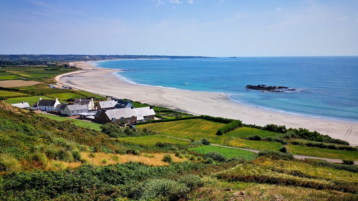
Beachcombing across the Channel Islands offers a captivating way to connect with maritime history, geology, and the rhythmic pulse of the Atlantic Ocean. For those drawn to the frosted gleam of ocean-tumbled glass, hunting for sea glass in Jersey reveals a landscape shaped by colossal tides, shifting shingle bars, and centuries of seafaring heritage. Every fragment washed ashore began as ordinary discarded bottles, tableware, or ship ballast, slowly smoothed over decades by abrasive sands and churning currents. Searching for sea glass jersey channel islands shores provide requires both an eye for detail and a grounded respect for the coastal environment. In this guide, I share practical insights on identifying prime shorelines, reading the island's formidable tidal movements, and beachcombing responsibly across Jersey's distinctive bays.
St. Ouen's Bay: Maritime History on the Wild West Coast
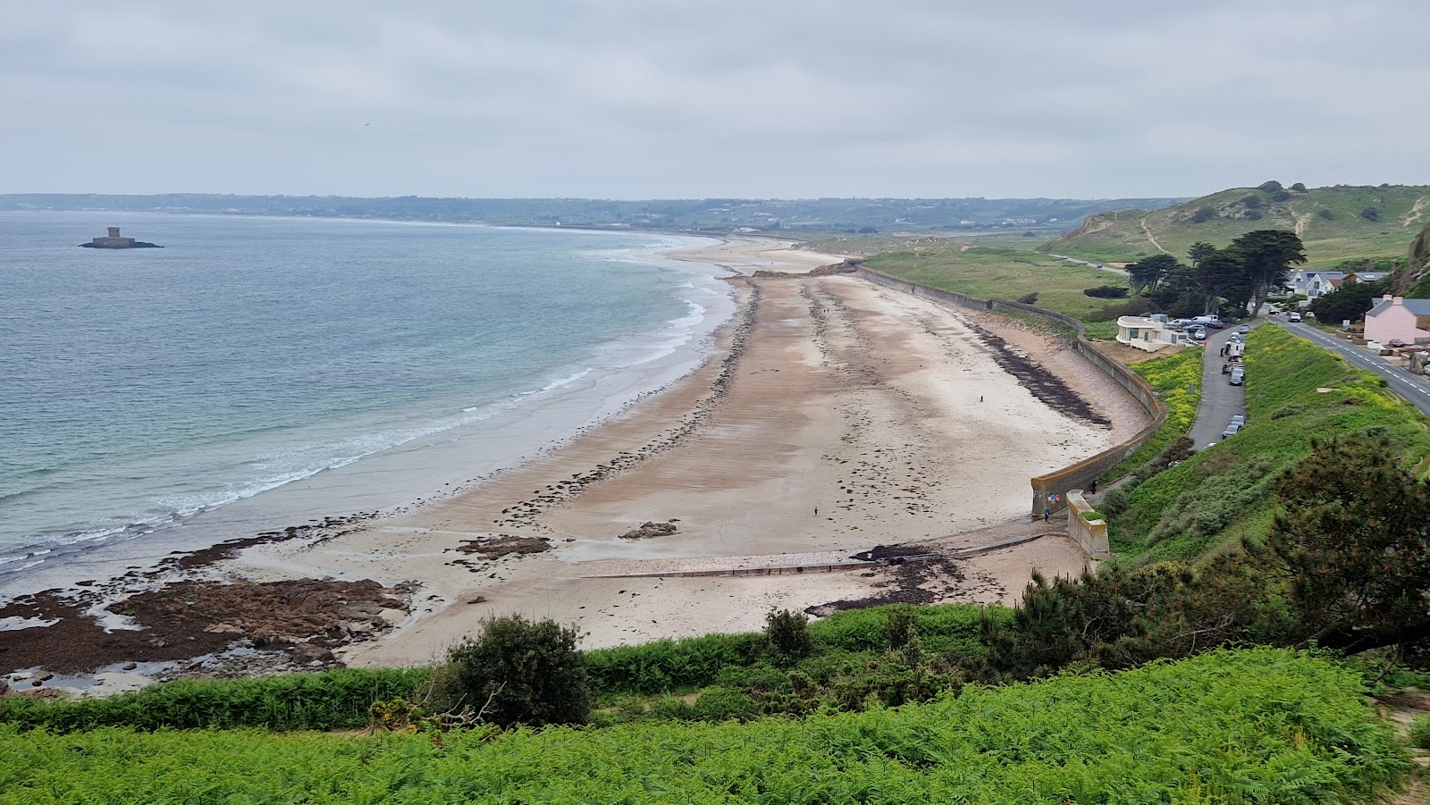
Stretching along the dramatic western edge of the island, St Ouen's Bay is widely celebrated as one of Jersey's most expansive shorelines and a prime destination for beachcombing and sea glass enthusiasts. Renowned for its turquoise waters and sweeping golden sand, this open bay bears the direct brunt of Atlantic swells, creating dynamic surf and constantly sifting coastal deposits. Its enduring reputation among beachcombers is deeply tied to a long and storied history of maritime shipwrecks. Over centuries, vessels navigating the perilous reefs off Jersey's west coast lost cargo and equipment, leaving behind fragments that have spent generations being natural tumbled by heavy rollers against submerged granite ledges.
When searching for a sea glass beach jersey visitors often head towards areas where the sand mingles with coarser shingle or detritus lines left by receding swells. Because the bay is so vast, conditions can vary significantly between northern and southern points. While surfers gather where the breakers are most consistent, beachcombers can walk along the high-water strandline or inspect the wet flats at low water where heavier items settle. The tumbling action in St. Ouen's Bay produces well-frosted, rounded gems, primarily in classic maritime shades such as kelp green, amber brown, and soft aqua. Exploring this coast offers a sense of vast openness, where the relentless rhythm of the Atlantic continually exposes relics of island trade, fishing fleets, and seafaring eras past.
Green Island: Sheltered Coves and Tidal Treasures
Located on the island's south-eastern coastline in the parish of St Clement, Green Island presents a completely different shoreline character compared to the exposed west. Tucked into a sheltered pocket, this scenic spot is widely recognized as a prime location on Jersey for discovering sea glass, delicate shells, and diverse tidal treasures. The beach features soft sand bordered by rocky outcrops, reefs, and an abundance of rock pools that trap light debris carried in by the tide. For beachcombers seeking sea glass jersey shores have to offer, the gentle washing of water over the flats here often preserves smaller, delicate fragments that might otherwise be crushed against heavy boulder banks.
A central feature of the bay is the rocky islet of La Motte, known locally as Green Island, which gives the cove its name. This grassy rock can be reached on foot across the exposed seabed during low tide, creating a uniquely engaging shoreline stroll. However, beachcombers must maintain careful awareness when exploring around La Motte: the islet becomes cut off from the main shore during high water. Bringing a small bucket or pouch is ideal for gathering jewels of the sea along the gravel veins, but one must always monitor the rising sea level. Because the water spreads swiftly across the low-gradient sand flats, tracking the state of the tide is essential to ensure a smooth return to the main beach before the pathway back is submerged.
Navigating Jersey's Extraordinary Tidal Range
Any beachcombing excursion in Jersey must be planned around the sea, as the Channel Islands experience one of the world's largest tidal ranges. When the tide recedes, vast expanses of sand, submerged reef systems, and rock gullies are revealed, essentially doubling the accessible footprint of the island. Conversely, when the tide turns, water advances with dramatic speed, filling hollows and cutting off sandbars long before high water is reached. Understanding this movement is critical not only for personal safety but also for pinpointing the best windows to find freshly deposited sea glass.
| Tidal State | Beachcombing Conditions | Safety & Timing Guidance |
|---|---|---|
| Falling Tide (Ebb) | Exposes wet gravel lines, untouched rock pools, and newly deposited material from the previous high water. | Optimal window to begin searching; follow the receding line seaward while tracking landmarks behind you. |
| Low Water | Maximum shoreline exposed; access to offshore reefs, islets, and deep sand gullies. | Turnaround point; start planning your path back towards main access slipways before the water shifts. |
| Rising Tide (Flood) | Rapidly submerges outer sand flats, fills gullies, and cuts off lower access points and islet causeways. | Move back to upper beach levels immediately; do not linger on sandbars or near isolated headlands. |
| High Water | Concentrates floating drift along the uppermost strandline; completely submerges certain beaches. | Inspect high-water seaweed wrack lines, but avoid coves where exits are cut off at full tide. |
Because the water moves so rapidly on the incoming tide, beachcombers should always verify published local tide times and current beach conditions before setting out. Waiting until the water is visibly lapping around your boots is dangerous on wide flats. The rising tide frequently sweeps into lower gullies behind your position, turning what appeared to be an accessible sand spit into an isolated sandbank surrounded by deep water.
Rocky Reefs and Gullies at La Rocque Harbour
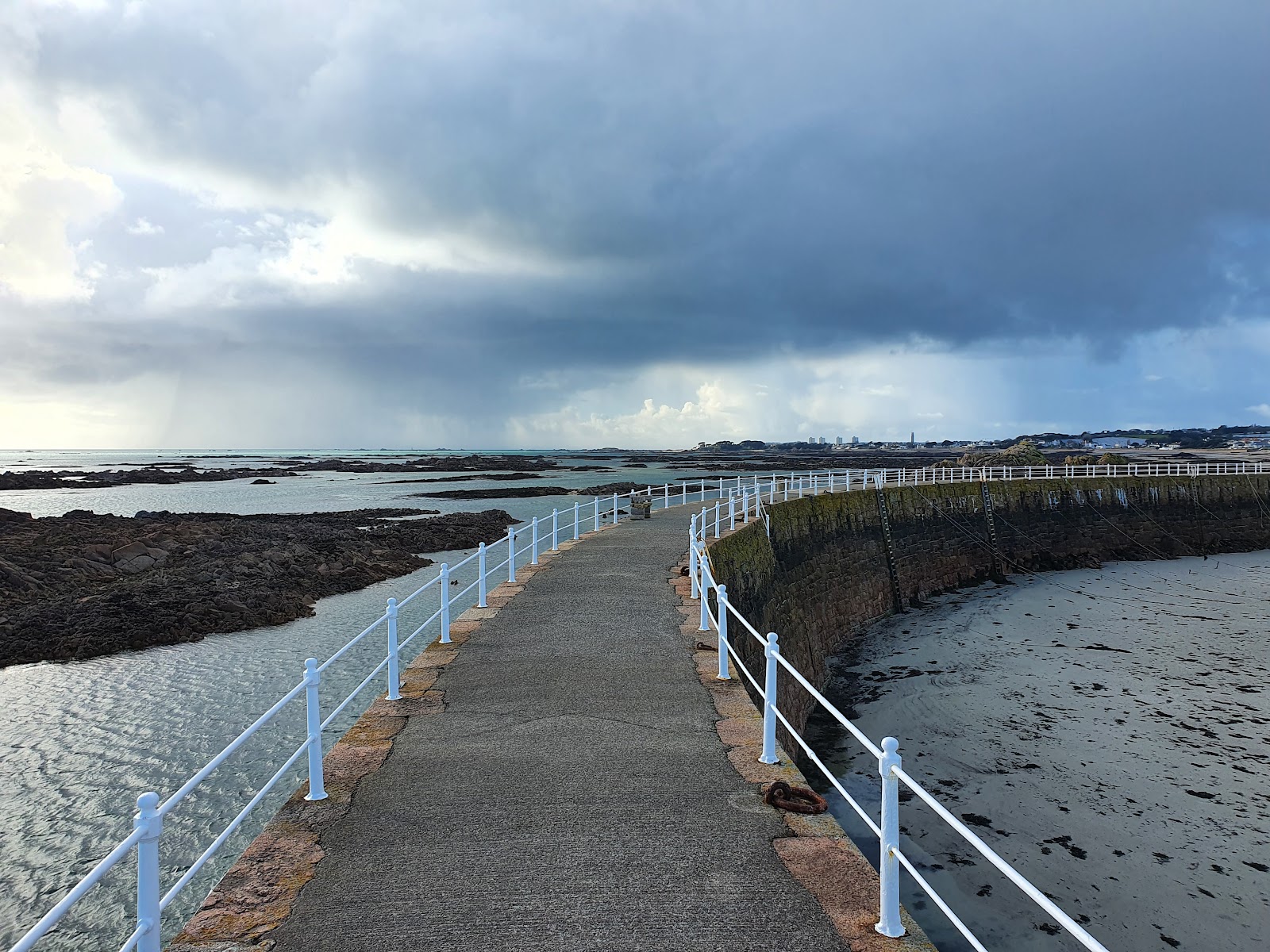
Just east of Green Island on Jersey's south-eastern tip lies La Rocque Harbour, a historic granite breakwater surrounded by a wilderness of exposed marine topography. At low tide, the sea recedes across an expansive lunar-like plain of sand, deep rocky gullies, and jagged reef outcrops. Historically known as the landing point for French forces prior to the Battle of Jersey in 1781, La Rocque today attracts rock poolers and beachcombers eager to search the crevices of the seabed.
The intricate rock formations around La Rocque serve as natural sieves, catching all manner of marine debris, sea glass, and shells as the tidal currents sweep across the south-east coast. However, this complex terrain demands substantial caution. The area is subject to powerful currents, and the rapidly rising tide fills deep internal gullies well before covering the higher rocky mounds. Beachcombers navigating the reefs must never lose sight of their escape routes to the harbour pier and shoreline, ensuring they head back to safety long before the incoming surge cuts off their path.
Shingle Strands and Sandy Transitions at Anne Port Beach
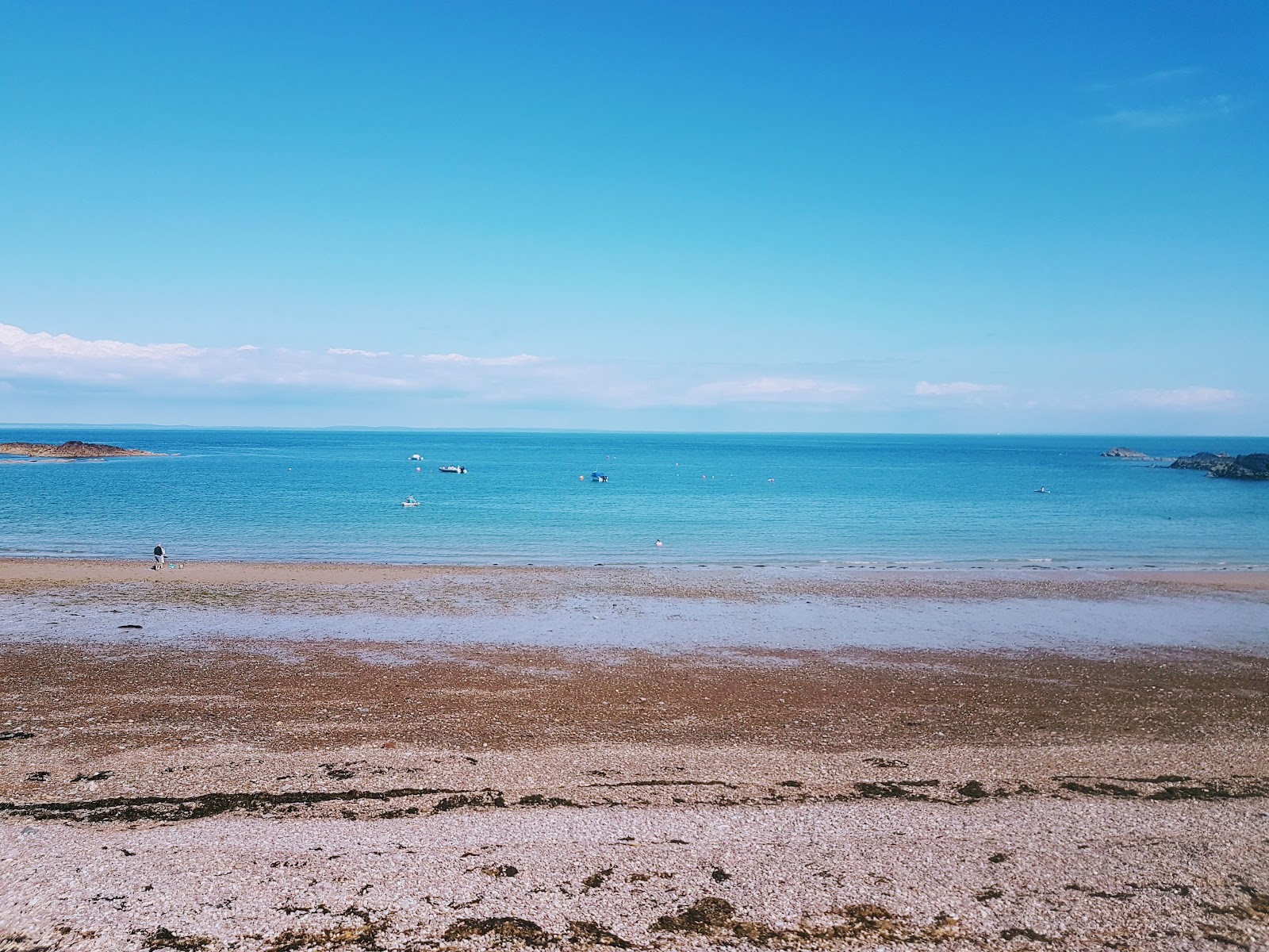
For collectors who prefer searching through sorted gravel and shingle rather than wide sand flats, Anne Port Beach on the island's north-east coast offers an intriguing profile. Situated between Gorey and St Catherine, this east-facing bay features a distinct shingle beach that gradually transitions to fine sand at mid-to-low tide. The shoreline is sheltered from prevailing westerly winds, nestled beneath the high headland of Le Saut Geoffroi.
Shingle beaches are often highly productive for sea glass hunting because tumbling action is concentrated among the rounded stones. As small pebbles roll back and forth in the gentle surf, fragments of glass are abraded into soft, frosty nuggets and naturally sorted by size. At Anne Port, beachcombers can carefully scan the band where the shingle bank meets the sand, particularly at mid-tide when receding waves wash away loose sediment to reveal heavier, smooth pieces nestled between the stones.
Cove Combing and Submerged Sands: Plemont and Beyond
Exploring Jersey's rugged northern and south-western corners reveals spectacular enclosed coves, though each presents distinct tidal characteristics that every visitor must respect. At Plemont, located along the north-western coast, towering headlands enclose a picturesque sandy bay famous for sea caves and dramatic scenery. However, Plemont is a prime example of a beach that is entirely submerged at high tide. The sea swallows the sand completely, and crucially, access to the cliff steps leading back to the car park can be cut off by the rising tide well before full high water arrives.
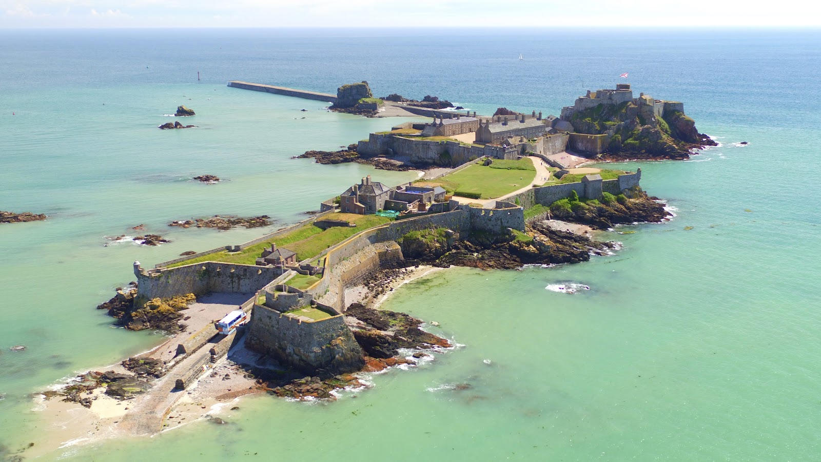
Similarly sheltered bays along the south coast, such as Beauport Beach with its granite cliffs and low-tide rock pools, or Ouaisne Bay connected at low tide to its neighbour St. Brelade's Bay Beach, offer serene coastal walks and gravel lines to inspect. Meanwhile, along Victoria Avenue in the south, St. Helier Beach provides sweeping views toward Elizabeth Castle, where the dramatic tidal swing opens up a walkable causeway over the seabed at low water. Whether walking the open reaches of St. Helier or exploring secluded northern coves, keeping a constant eye on the water level is an absolute necessity.
Marine Protection and Coastal Conservation Etiquette
While beachcombers often focus on scouring the strandline, protecting the fragile coastal environment of the Channel Islands is paramount. Shoreline ecosystems provide critical habitats for marine life, nesting seabirds, and delicate intertidal organisms. Responsible collecting means leaving the coast as undisturbed as possible, ensuring that the natural balance of these shorelines remains preserved for future generations.
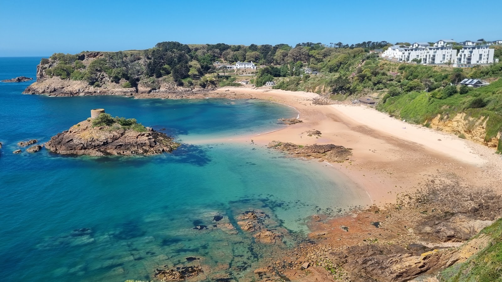
Certain stretches of the Jersey coastline operate under strict statutory conservation designations. A prime example is Portelet Bay on the southern coast. Since May 2022, Portelet Bay has been formally protected as a No Take Zone, where all forms of fishing and extraction are prohibited to support scientific research and enable the marine environment to develop naturally without human interference. While picking up weathered, man-made sea glass from the strandline is distinct from extracting living marine life or harvesting seafood, visitors must strictly respect all local conservation guidelines, marine reserve boundaries, and bay regulations.
- Target Man-Made Debris: Focus your collecting on man-made sea glass and shoreline litter rather than removing large quantities of natural pebbles or disturbing living fauna.
- Inspect Before Collecting: Always examine shells and hollow objects to confirm they are completely unoccupied before pocketing them.
- Leave Inhabited Pools Untouched: Never overturn heavy rocks or disrupt delicate rock pool habitats in search of hidden glass fragments.
- Pack Out Modern Waste: Carry a bag for non-tumbled modern rubbish, fishing line, and plastics to leave the shoreline cleaner than you found it.
- Adhere to Local Postings: Always observe posted reserve notices, seasonal bird-nesting boundaries, and local parish guidelines across every bay.
Essential Gear and Shoreline Strategies
Success when searching for sea glass depends heavily on preparation, patience, and adapting your method to the shoreline surface. Walking quickly across dry sand rarely yields results, as smooth glass easily sinks beneath the surface or blends into dry shells. The most productive searching takes place slowly, observing the wet fringe where water clarifies colours and highlights the subtle frosting of worn glass.
- Sturdy Footwear: Moving across shingle bars, slippery kelp beds, and sharp granite reefs requires footwear with excellent grip, such as durable walking shoes, neoprene beach booties, or well-treaded boots.
- Hands-Free Carrying: Use a canvas shoulder bag, small backpack, or lightweight bucket to keep your hands free for balance while negotiating rocky gullies.
- Tide Tables and Timing Devices: Keep a verified local tide chart accessible on your phone or carry a printed schedule, setting a timer well in advance of low water to ensure you begin your retreat in ample time.
- Weather Protection: Coastal Jersey is prone to rapid weather shifts, with bracing Atlantic breezes on western beaches like St. Ouen's and intense reflection across sun-trap coves. Pack wind-resistant layers and sun protection.
When searching pebble banks or shingle patches, such as those at Anne Port, crouch down and scan a small radius rather than looking ahead while walking. Look for symmetrical curves, distinct frosted surfaces that do not reflect glare like polished quartz, and unusual pastel tones. Pale seafoam greens, rich ambers, soft whites, and vintage cobalt blues each carry distinct tactile qualities that distinguish them from surrounding natural stones.
Planning Your Jersey Beachcombing Excursion
Hunting for sea glass around Jersey offers a rewarding journey through the island's coastal geography, where expansive Atlantic surf beaches contrast with intimate granite coves and vast intertidal reefs. From the wreck-strewn shores of St. Ouen's Bay to the tranquil shell-scattered sands of Green Island, the island's unique position in the English Channel makes it a remarkable environment for beachcombers who value history, nature, and shoreline discovery.
By synchronizing your visits with the outgoing tide, respecting marine conservation zones like Portelet Bay, and maintaining sharp awareness of rapid water advances at spots like La Rocque and Plemont, you can enjoy a safe, memorable, and environmentally conscious treasure hunt along Jersey's dynamic coastline.
Cover photo: St Ouen's Bay - Jackie Teng
By Alyssa.
Sources and further information
Sources checked: 2026-11-12.