Things To Do
Visiting La Corbière Lighthouse: Causeway Access, Tide Times, and Safety
Updated 22 October 2026
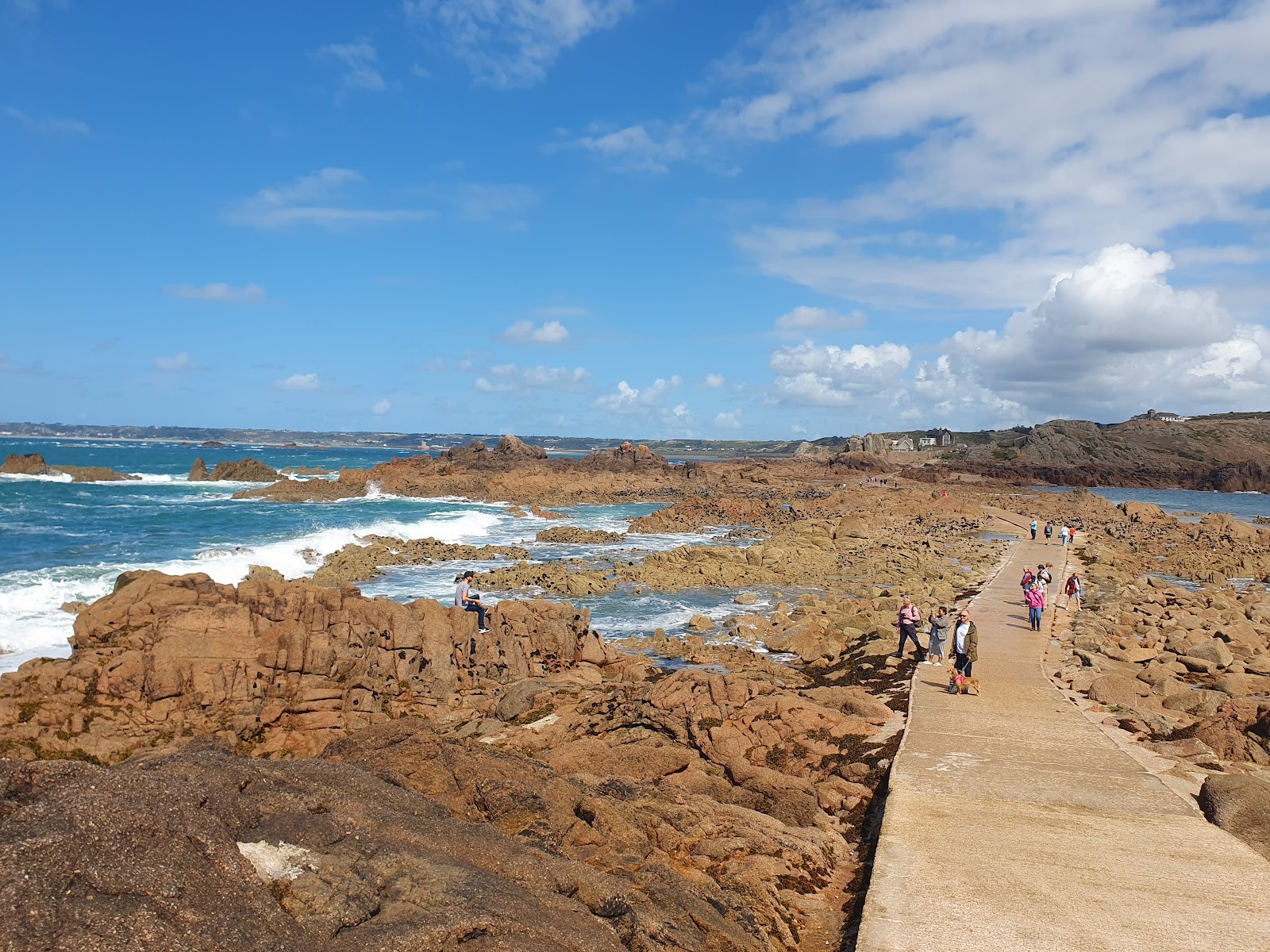
Standing on the windswept headland of south-western Jersey, watching the Atlantic swells surge against the dark granite rocks, you quickly understand why mariners historically regarded this coastline with profound caution. Set on an isolated outcrop of stone just offshore stands Corbiere Lighthouse (La Corbiere), a distinctive white tower that has guarded the island’s western approaches since the late nineteenth century. For walkers and curious travellers, strolling down from the headland and following the concrete causeway across the exposed seabed to reach the base of the tower is one of Jersey's most celebrated coastal outings. Yet because the landmark sits on a true tidal island, visiting safely requires careful attention to the sea, a clear understanding of local tides, and strict respect for safety warnings.
In this practical visitor guide, I will walk you through everything you need to know before setting off. We will examine how Jersey's extreme tidal range governs access, how the warning siren and local signs function, what to expect on a guided interior tour, and what you can explore around the headland whether the tide is fully in or out.
Understanding the Causeway and Tidal Windows
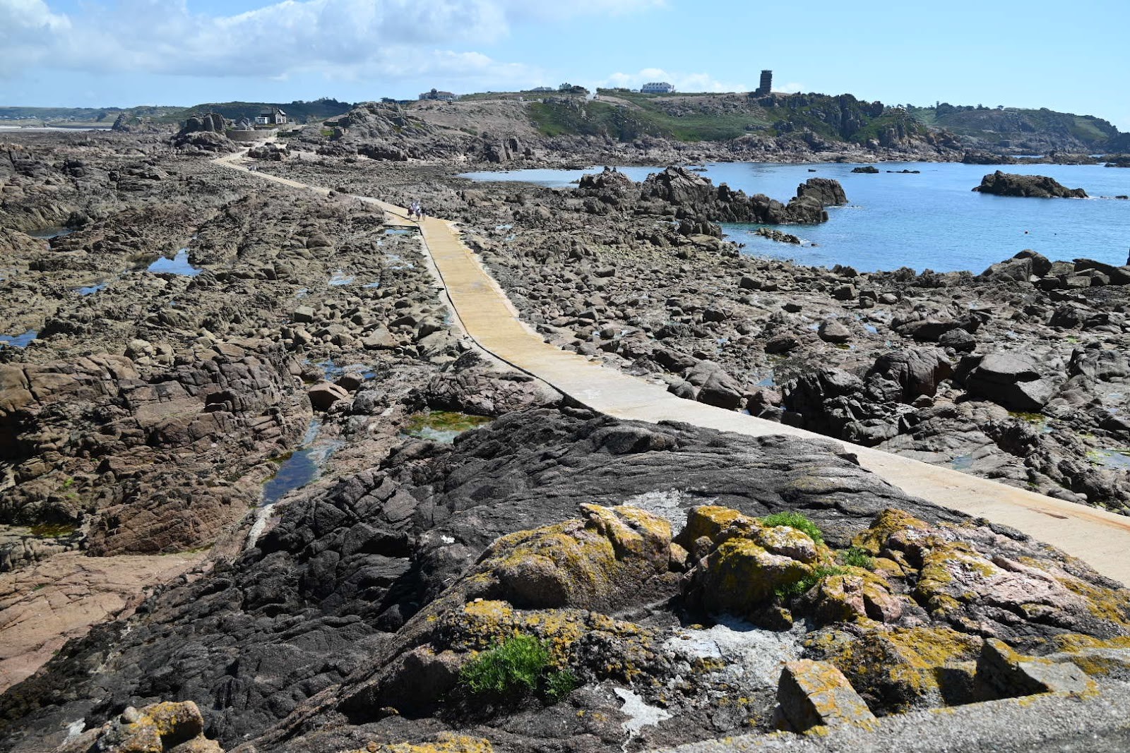
The defining feature of any excursion to La Corbière Lighthouse is the concrete causeway connecting the mainland cliff base to the rocky islet. Unlike a permanent bridge, this concrete path spends hours each day submerged beneath several metres of ocean water. It is uncovered strictly around low tide, emerging from the sea to offer temporary foot access across the reefs and shallow gullies.
Jersey experiences some of the most dramatic tidal swings in the world. As millions of tonnes of seawater move into the Gulf of Saint-Malo and drain away, the sea level shifts drastically between high and low water. At high tide, waves crash directly against the lighthouse foundation, isolating it from the shore. As the tide ebbs, an expansive landscape of granite outcrops, kelp gullies, and rock pools appears. When the tide falls sufficiently, the causeway clears entirely, allowing pedestrians to walk from the headland ramp towards the base of the beacon.
Because access is restricted to low water, consulting an up-to-date Jersey tide table before setting out is essential. The core rule for walking the causeway is to centre your trip around low tide. Never attempt to cross while the path is still covered by retreating water, and never wait on the rocks until the incoming tide begins spilling across the concrete. Seawater pushes back into side gullies surprisingly fast before washing across the path. Arriving as the causeway dries ensures plenty of time to enjoy the walk out, explore the base, and stroll back well before the tide returns.
Safety Precautions, Warning Signals, and Ocean Hazards
Walking across the causeway to the lighthouse is straightforward on a calm day, but tidal islands inherently demand caution. Failing to plan around rising water or ocean conditions can quickly turn an enjoyable walk into a dangerous emergency.
The Warning Siren
To protect visitors, an audible warning siren is installed at La Corbière. This siren gives advance notice that the incoming tide is rising and the causeway will soon be submerged. If you are on the lighthouse rock, exploring the surrounding pools, or midway along the path when that siren blares, you must immediately pack your gear and walk directly back to the mainland. The siren is not an invitation to snap a few final photos; it is an active signal that your safe crossing window is closing.
Reading On-Site Signs and Respecting Sea Conditions
At the approach path and near the start of the causeway, clear safety signage outlines the immediate risks. It is vital to heed the on-site instructions. The primary rule emphasized by local authorities is simple: allow plenty of time to return, and never wait for rising water to reach the path before heading back. If you wait until waves wash over the concrete, the current can be stronger than expected, and deeper dips can submerge before you realise it.
Weather and swell are just as critical as astronomical tide tables. Because La Corbière sits exposed at Jersey's south-western tip, Atlantic swells and strong westerly winds frequently generate powerful surf. Heavy waves can surge over sections of the causeway even when the tide should theoretically permit passage. When strong winds or high swells are forecast, you should never venture onto the causeway. Watching the waves crash over the rocks from the safety of the headland above offers a magnificent spectacle without any risk.
Footwear and Rockpool Hazards
The causeway surface is concrete, but regular submersion leaves it coated with slippery sea algae, damp sand, and maritime film. Sturdy walking shoes or trainers with dependable rubber grip are far better than smooth-soled shoes or sandals. If you step off the concrete walkway to explore rock pools, remember that wet granite boulders and thick seaweeds are slick. Watch your footing, avoid jumping across wet crevices, and always keep an eye on the path and the incoming tide.
The Architecture and Maritime History of the Lighthouse
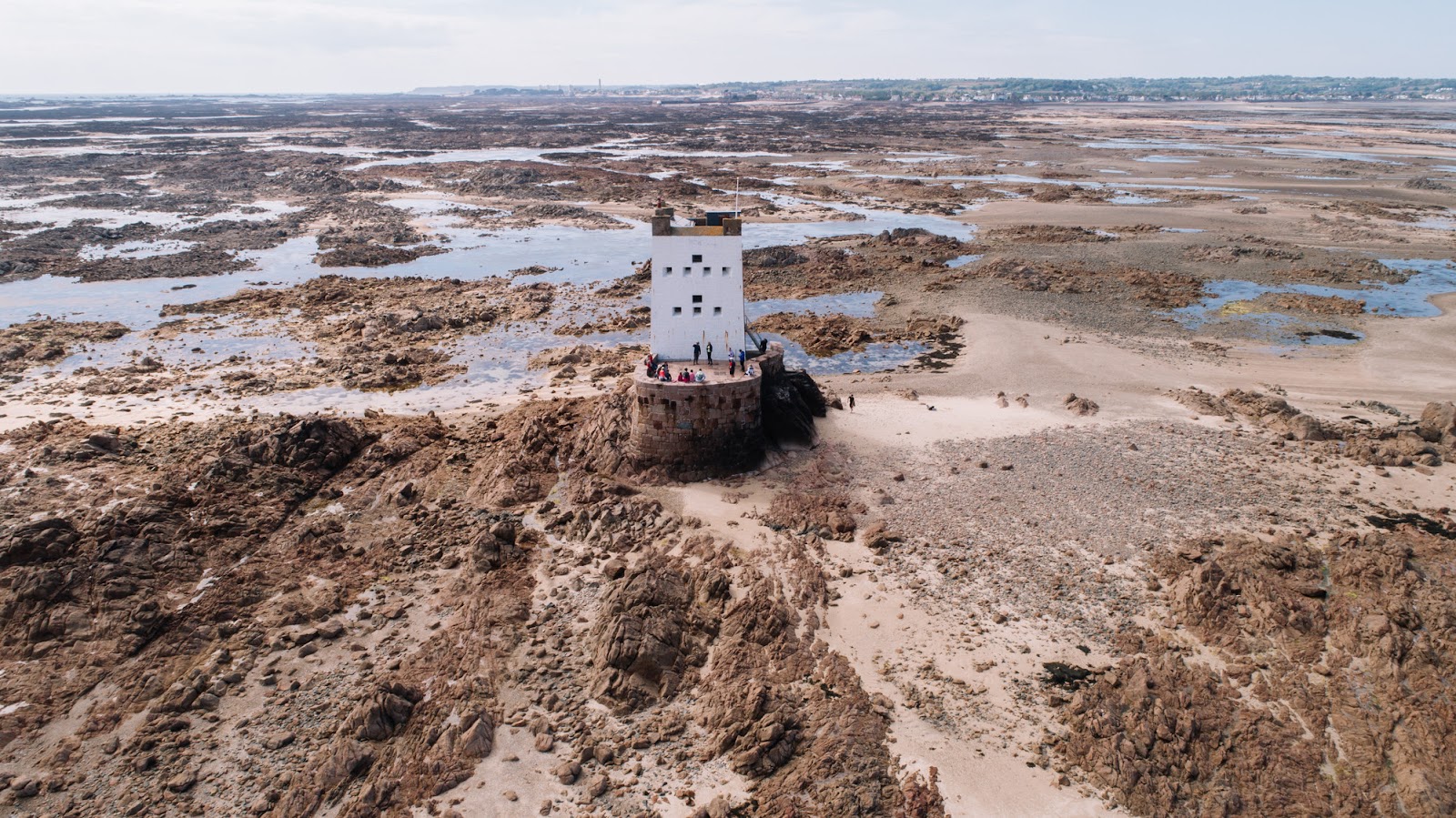
Reaching the foot of the lighthouse brings you up close to a landmark with an esteemed place in maritime engineering. Completed in the 1870s, La Corbière holds the distinction of being the first lighthouse in the British Isles to be built from reinforced concrete. Its primary lamp was first lit in 1874, offering a crucial navigational aid for merchant ships, passenger ferries, and local fishing boats navigating the treacherous waters off Jersey's south-western corner.
Prior to the beacon's construction, navigating past the jagged offshore reefs in poor visibility or stormy seas led to frequent shipwrecks. The French writer Victor Hugo, who lived in exile in Jersey, famously referred to the surrounding seascape as "The Herdsman of the Waves", while Channel Island sailors routinely spoke of "the dreaded Corbière". The cylindrical white tower stands atop an elevated granite base, elevating its lantern high above the sea so that its warning light remains visible for 18 nautical miles in clear atmospheric conditions.
For most casual visitors walking the causeway at low water, public access is restricted to the exterior base platform, the granite surroundings, and the lower entrance steps. The interior of the working lighthouse remains locked to protect operational navigational aids. However, pre-booked guided interior tours are available on selected dates. Guided tours led by Jersey Uncovered Blue Badge guides allow visitors to step inside the tower. Guests climb an authentic cast-iron staircase featuring a polished brass handrail, view preserved nineteenth-century instruments, and hear vivid historical accounts of the lighthouse keepers who maintained the light before modern automation.
These specialized interior tours meet at the lower car park and are strictly subject to low tides, suitable weather, and guide availability. To ensure safety in the confined spaces, groups are limited to a maximum of eight guests inside the tower at one time, and the tour is not suitable for children under the age of eight.
Exploring the Corbière Headland and Historical Memorials
Even when high water submerges the causeway and cuts off foot access to the lighthouse, the headland above provides an exceptional destination. The clifftops feature walking paths, panoramic viewpoints, and memorials reflecting Jersey's relationship with the ocean and wartime history.
The 'Saint Malo' Hands Sculpture
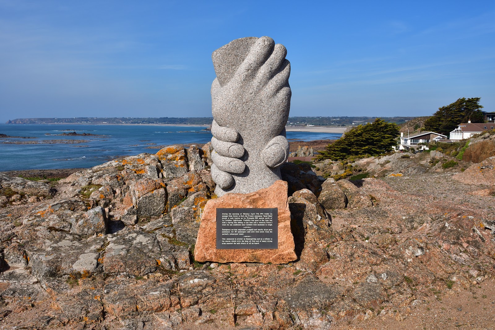
Positioned on the Corbière headland looking out across the sea stands the Sculpture of Two Hands Clasping. Officially titled the "'Saint Malo' Hands", this five-foot granite sculpture was created by Derek Tristram and unveiled in 1997. It was carved from a single block of Jersey granite that formerly served as part of the harbour wall.
The artwork commemorates a remarkable maritime rescue that unfolded directly off the headland. On 17 April 1995, the French commercial catamaran Saint-Malo struck a rock near La Corbière while carrying hundreds of passengers and crew. Thanks to the prompt efforts of local lifeboat crews, emergency services, and mariners, all 307 people aboard were evacuated safely without loss of life. The clasped hands stand as an enduring symbol of camaraderie and lifesaving, providing a poignant stopping point as you look out over the waters where the rescue took place.
Strongpoint Corbière and German Bunkers
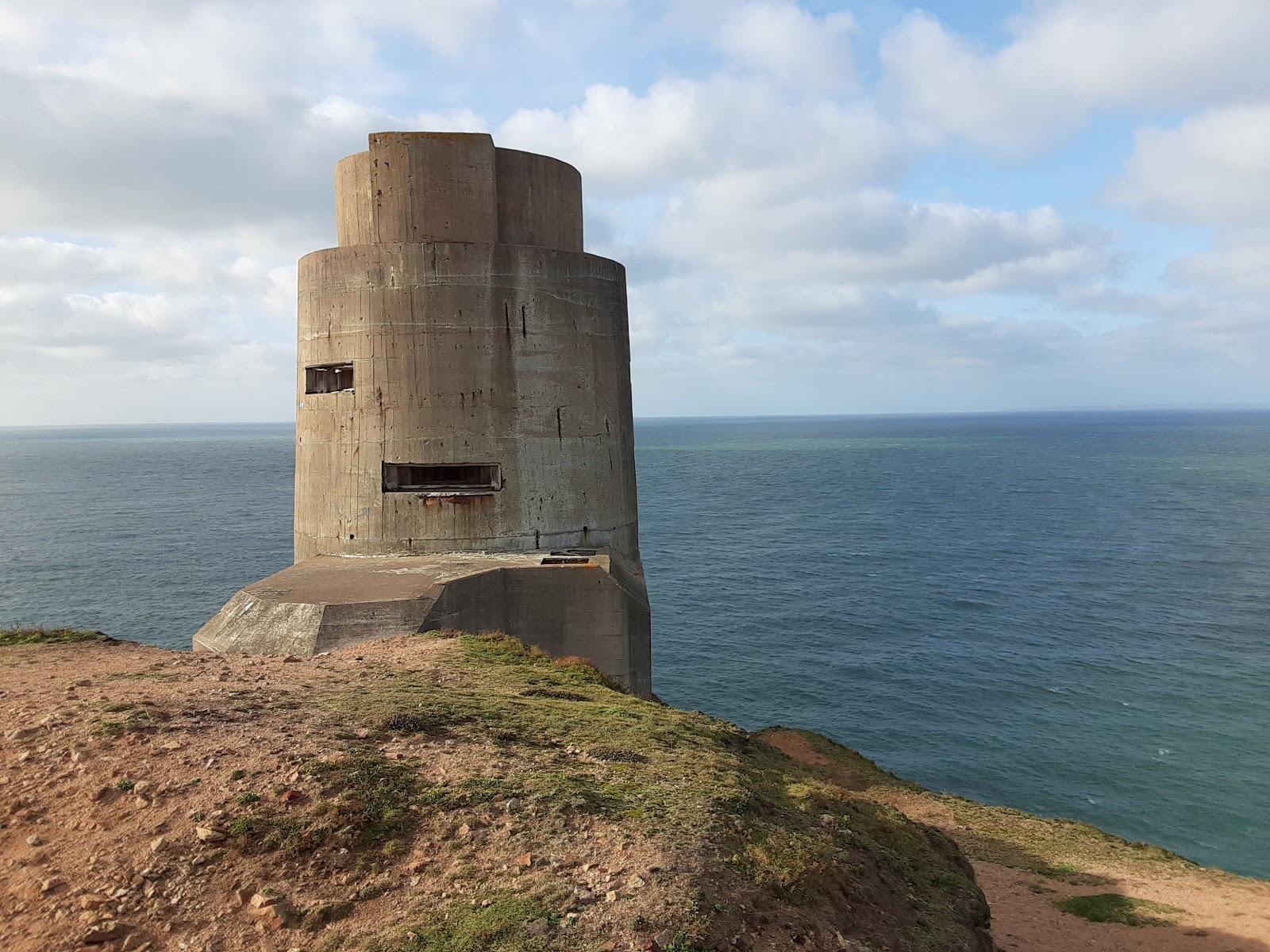
The same strategic position that made the headland vital for maritime navigation led to heavy fortification during the Second World War. During the German Occupation of Jersey between 1940 and 1945, occupying forces established Strongpoint Corbière as an integral coastal defence along Hitler's Atlantic Wall.
Today, visitors wandering the headland can view several formidable concrete bunkers and observation posts. Maintained and restored by volunteers from the Channel Islands Occupation Society (Jersey) Limited, the site features specialized defensive structures including Jägerstand artillery bunkers designed for 10.5 cm guns, a Regelbau 633 mortar bunker, a six-loophole machine gun turret (Sechsschartentürm), and an underground passage connecting fortified positions. On designated open days, the society allows the public to explore inside these restored positions to learn about the experiences of soldiers, forced labourers, and local islanders during the occupation years.
Coastal Walks, Headland Viewpoints, and Route Planning
Visiting La Corbière can easily be incorporated into a broader day of coastal exploration in western Jersey. Whether you arrive by foot, cycle, or vehicle, the headland provides some of the island's finest scenery.
Walking or Cycling the Railway Walk
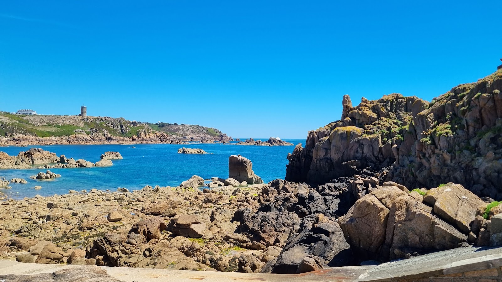
One of the most scenic ways to travel to the lighthouse is via the Railway Walk - St Aubin To Corbiere. This dedicated, traffic-free trail extends for approximately four miles, tracing the former route of the Jersey railway line that carried passengers between 1870 and 1936. Following the closure of the railway and its temporary reuse during the German Occupation, the tracks were lifted, and the corridor was transformed into a recreational trail.
The trail begins in the harbour village of St Aubin and climbs gently along tree-shaded paths and quiet lanes towards the western coast. With its level gravel surface, the route is popular with walkers, runners, cyclists, and pushchairs, and is noted as suitable for electric wheelchairs. As you near the western end, the trees give way to open coastal views overlooking the sweeping sands of St Ouen's Bay before concluding directly at the Corbière headland. It makes for an enjoyable journey linking the southern and western shores of the island.
Parking and Sunset Viewpoints
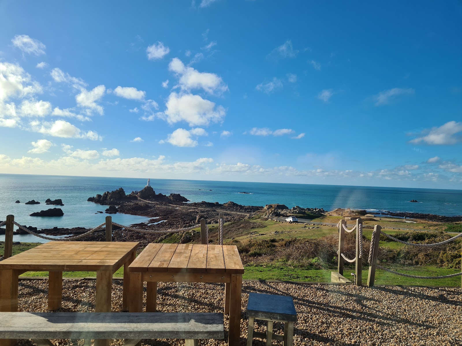
For those arriving by car, parking is available on the main headland as well as in the lower car park located closer to the causeway ramp. Because the headland faces west into the open Atlantic, it is celebrated as one of Jersey's premier sunset viewing locations. On clear evenings, visitors gather along the clifftop benches to watch the sun drop beneath the ocean horizon, casting the lighthouse in silhouette against vibrant evening colours.
Perched on the headland overlooking the sea sits Corbiere Phare, a restaurant offering wide panoramic window views across the lighthouse and causeway. It serves as a comfortable spot to pause for lunch, seafood, or an evening drink, allowing visitors to enjoy the dramatic seascape in warmth regardless of winds outside.
Practical Tidal Crossings Comparison and Visiting Checklist
To help you plan your journey, here is how the crossing to La Corbière compares with other well-known tidal causeways on Jersey:
| Tidal Location | Surface & Setting | Crossing Window | Key Safety Consideration |
|---|---|---|---|
| La Corbière Lighthouse | Concrete causeway across open ocean rocks | Uncovered strictly around low tide | Warning siren sounds before water covers the path; exposed to heavy Atlantic swell. |
| Elizabeth Castle | Paved and sandy causeway across St. Aubin's Bay | Low tide access from St. Helier waterfront | Amphibious passenger ferry runs during high water periods during normal castle opening. |
| St Aubin’s Fort | Stone and rocky causeway from St Aubin's Harbour | Accessible around low water | Self-managed timing required; no ferry service operates to the fort. |
To ensure your excursion to La Corbière Lighthouse is rewarding, safe, and stress-free, keep this simple checklist in mind:
- Check the tide times beforehand: Review daily high and low water times on an official Jersey tide table, planning to reach the causeway as it dries rather than late in the low-water cycle.
- Respect the siren immediately: If the warning horn sounds while you are on the rocks or at the lighthouse base, leave without delay and return directly to the headland.
- Never race the incoming tide: Always begin your return walk well before water reaches the concrete pathway.
- Dress for coastal terrain: Wear shoes with reliable traction to handle wet, algae-covered concrete and uneven granite.
- Watch sea swell and storm warnings: If Atlantic storms or heavy waves are breaking over the rocks, view the lighthouse from the safety of the headland cliffs.
- Book ahead for interior tours: Casual entry inside the tower is not permitted; book in advance if you want to climb the spiral staircase on an official guided visit.
- Explore the headland: Discover the 'Saint Malo' Hands rescue monument, explore the German fortifications at Strongpoint Corbière, or take the Railway Walk from St Aubin.
Cover photo: La Corbière Lighthouse - Trevor Wells
By Alyssa.
Sources and further information
- Lighthouse Tour — Jersey Uncovered
- Jersey Tide Times · Today's St Helier tides
- Railway Walk - St Aubin To Corbiere
- Corbiere Lighthouse (La Corbiere)
- Strongpoint Corbière
- Sculpture of Two Hands Clasping
Sources checked: 2026-10-22.